Weight
4 Kilograms
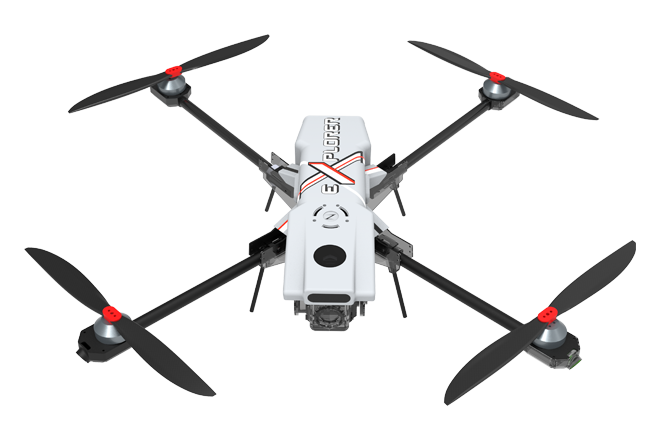
Indigenously designed and developed by ZAS, the Xplorer is a fully autonomous multi-payload, multi-mission quad copter. Integrating advanced sensors, processors, intelligent algorithms and on board computing, this performance-oriented UAV delivers tasks completely independent of human intervention and flight control. Autonomous navigation and manoeuvrability are its core strengths. Lightweight with a carbon composite structure, the Xplorer has an optimized flight time and operational range. Its versatility lends the platform the capability to perform a multitude of complex tasks. Beyond surveillance, the Xplorer’s inventory of advanced systems responds to the high demands of mapping, monitoring, payload delivery and other applications.
4 Kilograms
5 Kilometres
45 Minutes
• Dual Axis Stabilised Gimbal
• AES 128 BIT Encrypted Communication
Click to Go Function
Lightweight, Stealth & Portable
Networked Video Providing Realtime Visual Feed
MIL810 Grade Tablet
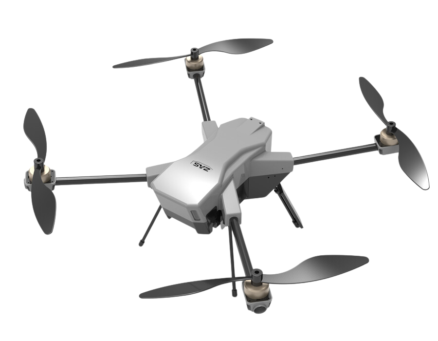
Introducing MapBot, your cutting-edge mapping drone redefining aerial data collection. With an impressive 50-minute flight endurance and an innovative 2-axis gimbal system, MapBot sets a new standard for mapping capabilities.
Say goodbye to short flight times and limited coverage. MapBot's extended 50-minute flight endurance allows you to cover vast areas in a single session, enhancing productivity and efficiency. The 2-axis gimbal ensures stable and shake-free camera movements, capturing high-resolution imagery critical for precise and reliable mapping.
Designed for both professionals and beginners, MapBot offers a user-friendly experience with intuitive controls and a straightforward interface. Real-time mapping capabilities provide live feedback during flight, enabling on-the-spot adjustments for accurate data collection.
MapBot's rugged construction ensures reliability in various environmental conditions. Its foldable design enhances portability, making it easy to transport to different mapping locations.
Unlock new perspectives and revolutionize your mapping projects with MapBot. Whether you're in surveying, urban planning, agriculture, or environmental studies, MapBot empowers you with precise aerial data collection and insightful data visualizations.
Experience the future of mapping technology with MapBot, your trusted companion for efficient and high-quality aerial data collection. Embrace the endless possibilities and insights that await you from the sky.
Up to 50 minutes of continuous flight time per battery charge.
Capable of flying at speeds up to 40 kilometers per hour.
High-resolution camera with a sensor capable of capturing images at 20 megapixels.
• Maximum Altitude: Able to reach a maximum altitude of 400 ft above mean sea level (AMSL).
• Gimbal Stabilization: Equipped with a 2-axis gimbal system for smooth and stable camera movements during flight.
• Real-Time Mapping: Live streaming of mapping data with minimal latency, providing instant feedback during flight.
• Applications: Suitable for a wide range of mapping applications, including surveying, urban planning, agriculture, and environmental studies.
Enjoy an impressive 50-minute flight time, allowing you to cover extensive areas and complete large-scale mapping projects in a single session.
Capture shake-free and smooth aerial imagery with MapBot's advanced 2-axis gimbal system, ensuring high-resolution and precise mapping results.
Easy-to-use controls and an intuitive interface make MapBot suitable for both professionals and beginners, simplifying the data collection process.
Experience live mapping feedback during flight, enabling on-the-spot adjustments for accurate and efficient data capture.
Equipped with obstacle detection and avoidance systems, MapBot ensures a secure and worry-free mapping experience.
Built to withstand challenging environmental conditions, MapBot's robust construction ensures reliable performance in diverse terrains.
MapBot's design enhances convenience, making it easy to transport and deploy in various mapping locations.
Capture detailed aerial imagery essential for generating precise and reliable maps, offering valuable insights for various industries.
Ideal for surveying, urban planning, agriculture, and environmental studies, MapBot empowers diverse mapping projects.
